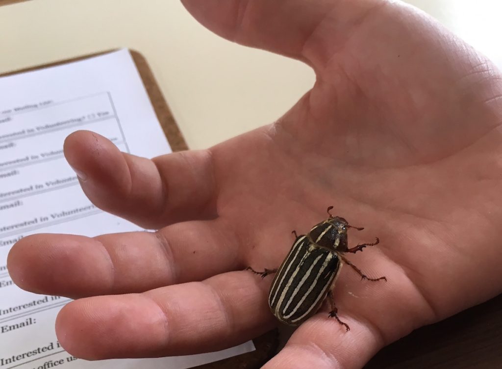
For those of you who have been waiting with great anticipation to hear the gender of the Ten-lined June Beetle, Polyphylla decemlineata, introduced in last week’s post, it’s a female. I guessed correctly. I emailed my photo to the nature center and heard back the next day from Suzie Fortner, the programs director of the non-profit Friends of the Dunes. In response to my questions confirming the name and the gender, she wrote:
Yes, that is a 10-lined June Beetle! Some people also call it a watermelon beetle. Only the males have the large feathery antennae, it helps them locate the female when they are in this reproductive life stage. The specimen in this picture is a female, probably about ready to lay eggs or about to die if she already laid her eggs. After spending years as a grub, they are only in this life stage for a month (typically June, but they were late this year), and all they do in this life stage is reproduce.
I wrote back:
Thanks so much for the information, Suzie. Do they stay in larval (grub?) stage in ground before emerging as beetle? The ranger on duty said they stay in ground for 7 years…is that right? I’m writing a blog post about my visit to the center. I’ll send it to you when I post it.
And Suzie wrote back:
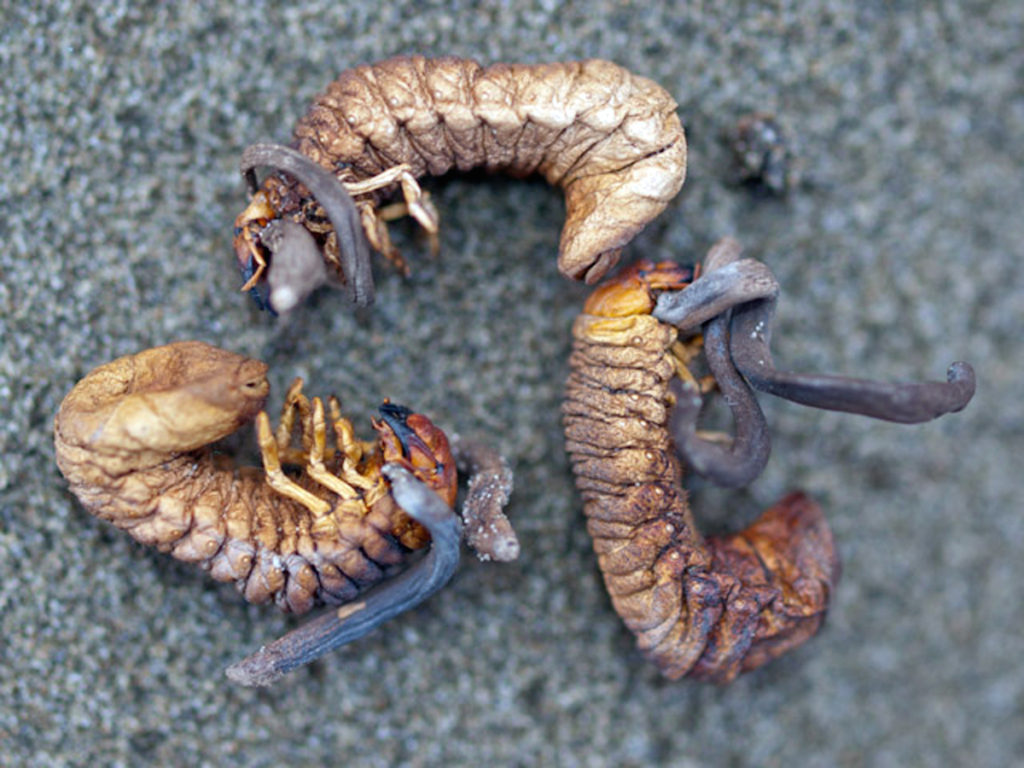
You probably spoke with our intern Blake, we do not have Rangers as we are a Non-profit & Land Trust. The entire life-cycle is 3-4 years. And yes, they live underground in the sand during the grub phase. Though sometimes they become infected with a cordyceps fungi which takes over their brain and grows out of their heads like antlers. The fungi causes them to climb to the surface in order to spread spores.
I wrote:
Wow. That’s amazing about cordyceps. Is the photo they label as male in this photo an example of the antler-like fungi or is that normal male antennae? Thanks so much for answering my questions.
She wrote:
That is normal male antennae. Here are some with the cordyceps.
Mind duly blown. (This photo definitely took me down a rabbit hole of research on cordyceps ;D).
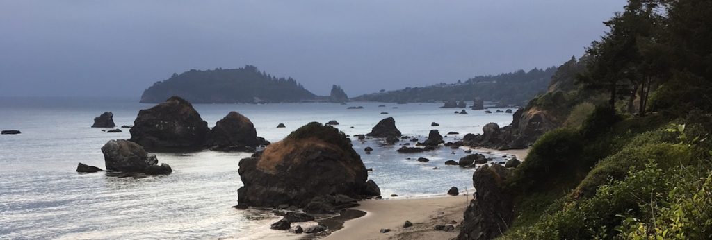
On this same trip, I knew that I was in river otter territory. I’ve seen lots of sea otters on the coast here in California but I had never seen a river otter in the wild. I was hoping to see one. Exploring the pier in the small town of Trinidad, I walked down a ramp from the main pier to a small wooden fishing pier below and just as I stepped onto the pier, a river otter came swimming directly toward me, and then dove under the water. A few boys were on the pier fishing and one said the otter had tried to steal his dad’s bait. When I do presentations and workshops, I talk about the River Otter Project here in the San Francisco Bay Area. I point people to the videos on their website, taken all around the Bay Area as part of their community science camera trapping project. When I got home, I did a little research and found my way to the River Otter demography study: a citizen science project. They had a form to record sightings in the Humboldt County. I was pretty thrilled to be able to enter my own sighting details.
Yesterday I received this email back:
Many thanks for your otter sighting at the Trinidad Pier! Some of the otters use these piers for foraging and possibly catching some leftovers from fishermen! We’re very glad you were able to catch your lone otter out there. No worries about the photo – maybe next time! [It moved too quickly for me to grab a photo.] Thank you again for your much appreciated contribution to the otter project! Hope to hear more from you soon!
Best,
Stephanie Cardenas, Research Assistant.

My point, in case you’re wondering: Citizen science is an awesome way to get hands-on and participatory, and to use technology for the greater good. Scistarter is a database of citizen science projects that you can search by keyword, topic, and area. Check it out. Has anyone noticed that the Seek app taps into the largest citizen science community of naturalists (540,000+ naturalists worldwide)? Observations of citizen science naturalists (20,000,000+ global observations) are what the Seek team uses to train their identification model, display ranges maps and generate nearby observations in Seek.
